Cheorwon

Siberian cranes walk on a frozen lake in the Civilian Control Zone in Cheorwon
My intention in coming to Cheorwon, the northernmost point of South Korea, was to get a glimpse of North Korea over the DMZ. That part of the trip was satisfied, and I got my fill of Korean People's Army watchtowers and North Korean villages in the distance.
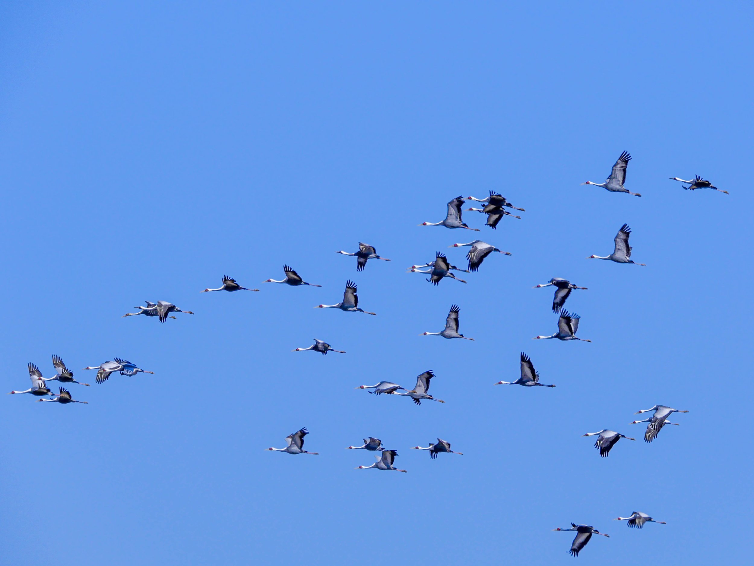
But the surprise came in the form of cranes.
Thousands of them, all the way from Siberia to spend the winter in the Civilian Control Zone (CCZ), located just before the DMZ and the military demarcation line between the two Koreas, a strip of heavily mined land where all human activity is severely restricted.
A veritable kingdom of cranes. A surreal natural spectacle amidst barbed wire, minefields and military vehicles.


The DMZ, where no-one is allowed except soldiers from both sides, and, to a lesser extent, the Civilian Control Zone have been inviolate wildlife sanctuaries since 1953. Migratory birds have spread the word. So have Asian black bears, mountain goats, musk deer and, according to some accounts, the Amur leopard and even the Siberian tiger.
Cheorwon is probably one of the best places to observe this phenomenon. Where animals have taken advantage of the geopolitical situation to take up residence in and around the DMZ, where no one would disturb them.
North Korean views

A North Korean military guard post, seen across the DMZ from the Cheorwon Peace Observatory.

The North Korean village of Pyonggang, seen from the Cheorwon Peace Observatory.

The Southern Limit Line, the DMZ and North Korean mountains on the background.
The Second “Tunnel of Agression”

A South Korean soldier stands guard at the end of the accessible part of the second infiltration tunnel.
This tunnel, which was dug by North Korea to invade the South, was the second to be discovered out of a total of four, and one of the three that are open to civilian visitors.
It was discovered on March 24, 1975, after South Korean guards heard the sound of explosions under the ground. After strenuous excavations, the soldiers found this 3.5 kilometers-long tunnel, measuring nearly two by two meters in size and penetrating South Korean territory for 1.1 kilometer, at a depth of between 50 and 60 metres. The use of this tunnel would have allowed for thirty thousand soldiers to pass through per hour.
Only a 500 meters-long section is open to the public. If you fancy the experience, you'll have to descend an interminable staircase and head down to the end, regularly banging your head against the granite ceiling (helmets are provided). The experience is not recommended for claustrophobics or people in poor physical condition.
North Korean leader Kim Il Sung is said to have ordered the completion of the tunnels in 1971. “One tunnel can be more powerful and effective than ten atomic bombs put together and the tunnels are the most ideal means of penetrating the South’s fortified front line”, he reportedly claimed.
Based on intelligence and on defectors accounts, it is estimated that there are around twenty more North Korean infiltration tunnels that have never been discovered, and are virtually impossible to detect. The role they would actually play in an invasion of the South remains a mystery.

Inside the Second North Korean infiltration tunnel near Cheorwon.
For further information on North Korean tunnels:
North Korea Has a Secret Weapon: Tunnels, Lots of Tunnels (article by Sebastien Robin, The National Interest, February 2020)
Woljeong-ri Station

End of the line. The former railroad between Seoul and Wonsan, a major port city now in North Korea, has been cut off from here for over 70 years. The fortifications right after the tracks mark the beginning of the Demilitarised Zone (DMZ) and North Korea is 2,000 meters away. But Woljeong-ri Station, near Cheorwon, and the surounding area is another bizarre place where tourist buses, South Korean tanks and self-propelled howitzers share the same roads and civilian visitors and soldiers go about their business, ignoring each other most of the time.
The Battle of White Horse Hill Memorial

One of the bloodiest and craziest fights of the Korean War (1950-1953) took place here, near Cheorwon, between the United States and South Korean forces on one side, and the Chinese and the North Korean forces on the other in October 1952.
The goal was the control of this strategic valley in Central Korea that gives easy access to the two parts of the Peninsula.
The hill changed hands 24 times after repeated attacks and counterattacks with heavy bombardments. It is calculated that the Chinese fired 55,000 shells and the South Korean forces 185,000 during the nine days of the battle. In addition, the US Air Force dropped more than 3,000 bombs of all kinds on the hill, including napalm.
After this deluge of fire, the hill, previously known as Hill 395, took on a shape reminiscent of a skeletal white horse, hence its name.
About 15,000 soldiers of both sides died here.
Ultimately, the South Korean forces took control of the hill. The front was later stabilized a few kilometers north, and those positions stand as the military demarcation line between the two Koreas until nowadays.
